SoCal Forecast
Updated most Sundays, Tuesdays, and Thursdays
Thursday 6/25/26 6:15 AM
By Nathan Cool
Surf Charts for SoCal
Rincon | Ventura, C-St. | County Line | Malibu | Hermosa | Huntington BeachTrestles | Old Mans | Oceanside | Beacons | Sunset Cliffs
Subscribe to be notified:
Get notified when this report is updated.
At a glance:
Today (Thursday the 25th) we have a good deal of SW ground swell in SoCal. Moderate southern hemi and light wind swell are due over the weekend. Light to moderate SW ground swell is due by the middle of next week, lasting through Sunday the 5th. A better sized southern hemi swell is being watched for the 6th-7th. And decent sized swells are becoming possible for the 9th-11th. Condition-wise: weather and winds shift over the next few days; tide levels swing wider over the next few days; and water temps are fair but there is a chance for upwelling this weekend.
|
|
|
Current Conditions:
Early this morning, periods were primarily running 17 seconds from 210°.
Most south facing spots were running chest to head high. Direct west facing breaks were mostly waist to chest, bigger at SW exposed spots.
Buoys in the outer waters were running 4-5'. Nearshore buoys were averaging 2.5'.
Tide levels will swing wider over the next few days as we approach a Full Moon Monday the 19th. Today we have a 3' high around 8:30 AM, a 2.5' low around 1:00 PM, and a near 6' high around 7:00 PM.
Water temps were running 66-68° around most of SD. OC was mostly 64-67°. Many LA spots were reporting 64-66°. In VC, Channel Islands Harbor reported 64° last night. In SB, Stearns Wharf reported 62° this morning. Note there is a chance for upwelling this weekend (page 148) from an impending wind event. This could cool water temps at some point over the weekend.
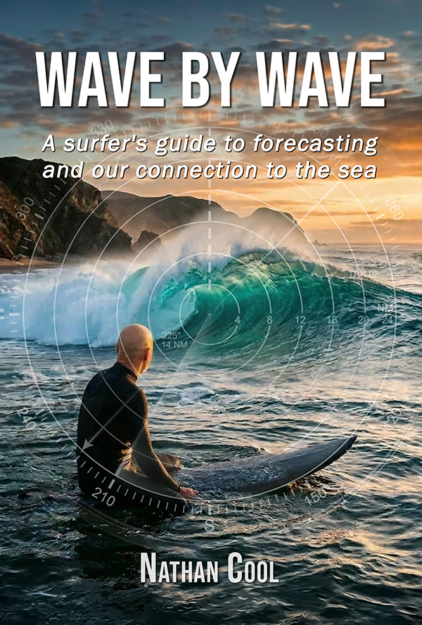
New Release: Wave By Wave
Take a journey into the hidden forces behind every swell and the ocean's connection to our human experience. After more than 30 years of tracking storms across the Pacific, Nathan Cool's latest book, Wave By Wave, takes you beyond basic swell prediction and into the deeper story behind the surf. From distant, powerful storms to the moment a wave breaks, you'll learn how to read the ocean with confidence and discover how these rhythmic forces bind us to the sea with a deeper sense of meaning.
Get the Book
Surf Forecast:
Today (Thursday the 25th) we're on the tail end of the SW ground swell sent our way from this system that drifted northward off Antarctica about 10 days ago (model generated by XyGrib from NFCENS data):

This should drop to about chest high at south facing spots Friday the 26th.
Saturday the 27th (building day) into Sunday the 28th (peak) should see SW ground swell from this system that passed south of New Zealand about a week ago (model generated by XyGrib from NFCENS data):

That wasn't a great course for SoCal swell. But with 30-35' seas it should produce chest max sets at south facing breaks, angled from 215° and periods 18 seconds. This swell should continue Monday the 29th with similar size.
Saturday the 27th (late) into Sunday the 28th, along with the southern hemi swell we should also see NW wind swell in the mix as this robust trough of low pressure digs south into SoCal (model by NOAA MAG):

This will affect SoCal weather and winds over the next few days and I'll get to that in those sections below. As for wind swell, this should be enough to create waist to chest high wind swell at west facing breaks by Sunday the 28th into Monday the 29th, angled from the wind-swell-usual ≥300° with periods 7-10 seconds. Other troughs of low pressure should follow with waist-high-ish wind swell lingering Tuesday the 30th through Friday the 3rd. Southern hemi though will be dominant with more southerly ground swells coming ashore.
Tuesday the 30th (building day) into Wednesday the 1st (peak) should see moderately sized southern hemisphere ground swell from these two storms that peaked a few days ago (model generated by XyGrib from NFCENS data):

ETA into SoCal is the same for both as storm #1, although being farther away, had longer periods than storm #2 (page 41). All told, south facing breaks should see chest high sets by Wednesday the 1st (building Tuesday the 30th) with swell angled from 190-210° and periods 17-18 seconds.
Thursday the 2nd (building day) into Friday the 3rd should see light to moderate SW ground swell from this system that was hugging the ice pack (model generated by XyGrib from NFCENS data):

Its initial easterly course from that extreme low latitude got very little improvement once tracking northeastward as its seas weakened. Running the numbers again this morning, this should produce chest max sets at south facing breaks by Friday the 3rd, angled from 200° with periods 18 seconds. This swell would continue Saturday the 4th with similar size. A similar but even lower latitude storm running behind it should keep waist to at times chest high waves going at south facing breaks Sunday the 5th.
Monday the 6th (building day) into Tuesday the 7th will likely see better sized SW ground swell from this system that's now on the 3-day models taking a better, wave-worthy course for SoCal swell (model generated by XyGrib from NFCENS data):

This should have much less loss from its angular spread (page 52), so running the numbers this morning works out to chest to head high swell at south facing breaks by Tuesday the 7th, angled from 215° and periods 19 seconds. This swell would continue with similar size Wednesday the 8th. This is on the 3-day models though so I'll firm it up in my Sunday report.
Thursday the 9th could see the next swell from this system on the 5-day models (model generated by XyGrib from NFCENS data):

So far, that works out to chest+ sets at south facing breaks, angled from 190° and periods 18 seconds. After peaking Thursday the 9th, more swell could arrive by Friday the 10th into Saturday the 11th from these two storms (model generated by XyGrib from NFCENS data):

Running the preliminary numbers this morning works out to chest to head high swell at south facing breaks by Saturday the 11th with swell angled from 190-200° and periods 18-19 seconds. There's even more southern hemi activity on the longer range, which is where attention is focused right now as the tropics remain active but not enough to whip up wave-worthy storms. All of this needs more monitoring, but as long as I have your support then I can continue to keep an eye on the Pacific to keep you posted. Please remember this report is funded by reader donations and your help is needed to keep this report alive (see why here).
|
|
|
Here's a brief look at how the next few days are breaking down so far:
Friday the 26th looks about chest high at south facing spots.
Saturday the 27th looks about chest max at south facing breaks and waist high at west facing spots.
Sunday the 28th looks about chest max at facing breaks and waist to chest at west facing spots.
Monday the 29th looks about waist to times chest at most breaks.
Tuesday the 30th is expected to run chest max at south facing breaks, smaller at west facing spots.
Wednesday the 1st looks about chest max at south facing breaks and waist high at west facing spots.
Thursday the 2nd looks about waist to at times chest high at south facing breaks.
Friday the 3rd, so far, looks about chest max at south facing breaks.
Saturday the 4th, so far, looks about waist to chest high at south facing breaks.
Sunday the 5th, so far, looks about waist high at south facing breaks with occasional chest high pluses.
Monday the 6th, so far, looks about chest high with swell building during the day.
Tuesday the 7th, so far, is looking at chest to head high sets at south facing breaks.
Wednesday the 8th, so far, looks about chest to head high at south facing spots.
Thursday the 9th, so far, looks about chest+ at south facing breaks.
Friday the 10th, so far, looks about chest+ at south facing breaks.
Saturday the 11th, so far, holds potential for chest to head high sets at south facing spots.
Weather Outlook:
Today (Thursday the 25th) high pressure has weakened and is moving southeast while this trough of low pressure approaches SoCal, shown here when it peaks over the weekend (model by NOAA MAG):
This will increase NW winds this weekend and it could bring morning drizzle to SoCal beaches this weekend too. But the marine layer will be affected differently than a normal trough-induced onshore flow as early AM winds could scour out the marine layer, especially north of LA, making the weekend a time that "if it's clear, then winds are near". On top of that, the inversion will be weaker this weekend. Right now, the thermal inversion over SoCal is running about Δ10°F (pages 131-135). But when that trough digs south this weekend, it should inject enough cold air into the upper levels to weaken the inversion to about Δ5°F max. In fact, some spots could see neutral temps, resulting in no inversion.
Once that trough passes Monday the 29th a couple others should follow, keeping a low pressure troughing pattern in place until Thursday the 2nd or Friday the 3rd. That's the turn-around point. Models show a decent, 595dm 4-Corners high Saturday the 5th that would strengthen each day to near the heat wave 600dm mark starting Tuesday the 7th. This would warm things up and initially keep the marine layer thin. But once SoCal's deserts heat up then the thermal inversion comes back into the picture, affecting the marine layer with its thickening agent.
Taking all of this into account, here's how I'm calling SoCal beach weather for the next few days:
Today (Thursday the 25th) should see AM marine layer with a burn-off by late morning and max beach temps in the upper 60s.
Friday the 26th should see AM marine layer with a burn-off by late morning and max beach temps in the upper 60s.
Saturday the 27th should see AM marine layer and possibly drizzle. Marine layer should dissipate north of LA by late morning but may linger farther south, especially in OC and SD, well into the afternoon. Max beach temps should reach the mid to upper 60s.
Sunday the 28th looks similar: AM marine layer and possibly drizzle...marine layer will likely dissipate north of LA by late morning but may linger farther south. Max beach temps should reach the mid to upper 60s.
Monday the 29th should see AM marine layer with a burn-off mid to late morning (earliest north of LA) and max beach temps in the mid to upper 60s.
Tuesday the 30th should see AM marine layer with a burn-off late morning and max beach temps in the mid to upper 60s.
Wind Outlook:
Winds
at 6:00 AM were lightly onshore in most spots 3-8 mph. Onshores should reach 15 mph this afternoon.
Friday the 26th should see AM light and variables with a slight southerly element and afternoon onshores to 15 mph, increasing mid to late afternoon with gusts to 20 mph.
Saturday the 27th should see early AM onshores 4-8 mph, increasing by noon to 15 mph, and then 20 mph by mid afternoon with gusts to 25 mph possible.
Sunday the 28th should see AM light and variables with an onshore element. Onshores should increase throughout the morning, reaching 15 mph by noon and up to 20 mph by mid afternoon.
Until my next report (Sunday), take care, be safe, and smile in the lineup!